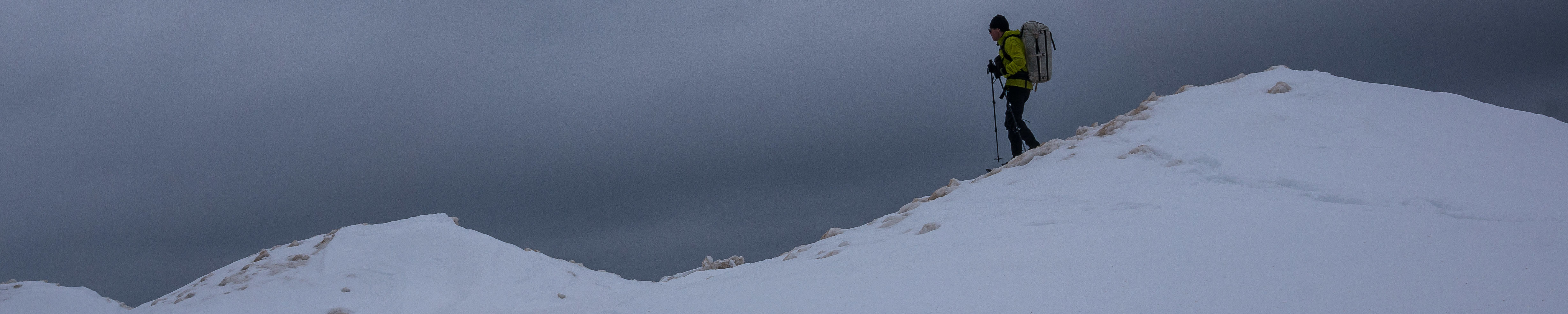
Planning a trip to Pictured Rocks in winter had been on my mind ever since I passed through all too quickly last May. Pictured Rocks had it all; gigantic sand dunes, sandstone cliffs, abundant wildlife, clear blue waters, and many hidden treasures. Problem was, everyone else knew it too. During peak season, Pictured Rocks sees thousands of visitors, and camping is limited to designated campgrounds within the park. In winter though, everything changes. Lake effect snow closes off the access roads and the park takes on a remote feeling. Subzero temperatures and 3-5 feet of snow base are the norm. Visits dwindle and camping regulations are relaxed.
I had originally planned to traverse the park from end to end in late January and arranged a shuttle to drive me from Munising to Grand Marais to start my trip. Unfortunately, the morning of the trip, one of our dogs developed a back injury and I regretfully cancelled the trip, unsure if the opportunity would present itself again this year.
Last week, it finally did. Our dog had recovered, work schedule had opened up, and my wife was encouraging of the effort. I had lost my shuttle ride, but resolved to at least do an out and back, covering as much ground as I could in the allotted 5 days.
On a side note, I’m not a huge fan of the out-and-back. For me, the point A to point B trek is ideal. Every step covers new ground and it is usually difficult to shortcut the route even if you are running low on time, so night hiking and high mileage days may be required. Dave Chenault said it best. “The glory of a traverse is that retreat is sufficiently inconvenient that you’re unlikely to indulge without very good reason.”
The loop hike is logistically easier, not requiring a shuttle, and again the scenery is always fresh. I consider it a step below the point-to-point though, because corners can be cut if needed. Then there is the out-and-back. No real surprises for the second half. Also, this type of trek encourages laziness, particularly on the turn-around day, because the further out you walk, the further you have to walk back. When I do this kind of hike, I make sure that I have a destination in mind right at the outset to avoid any waffling later. For this trip, I decided that I would at least get within eyesight of the Grand Sable Dunes.
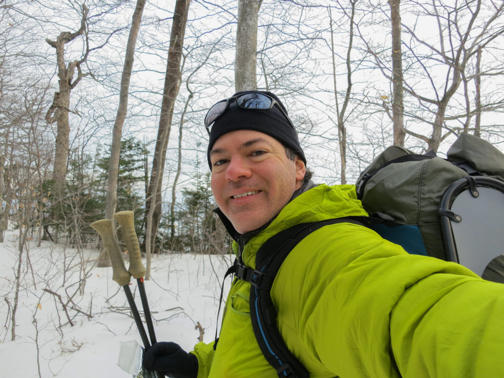
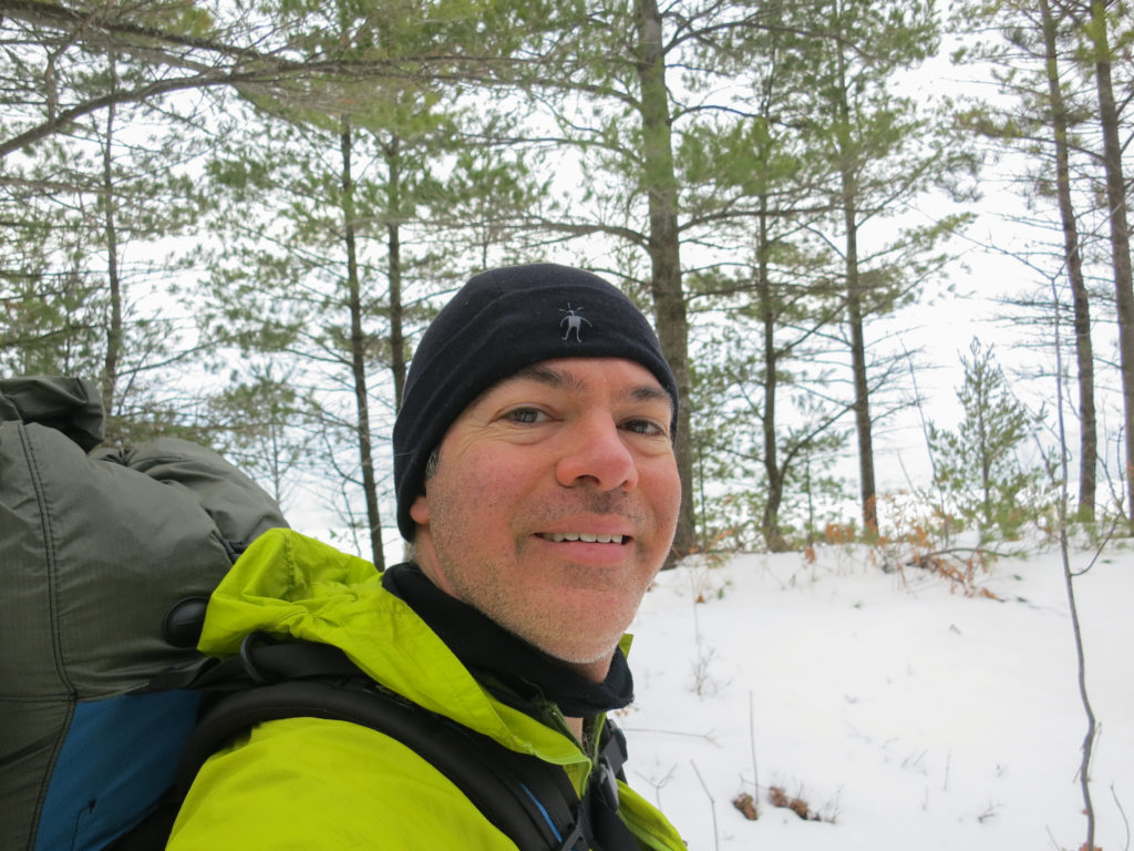
My backpack had been packed and ready for 3 weeks. My food was organized and waiting in the freezer. Finally the day came. At 2 am, I rolled out of bed, taking advantage of pre-trip excitement and the natural break in my circadian rhythm (I often wake briefly between 2-3 am) to start out feeling fresh. I started the drive to the Upper Peninsula, pausing briefly at 5 am for a greasy spoon breakfast of steak and eggs. I made it to Munising by 9 am as the park service office opened to pick up a backcountry permit. The park service agent seemed discomfited that I was setting out alone, and questioned me in detail about my itinerary before issuing my permit.
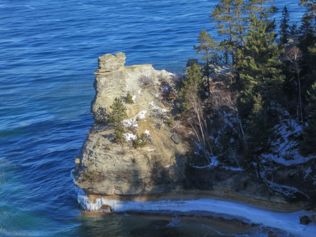
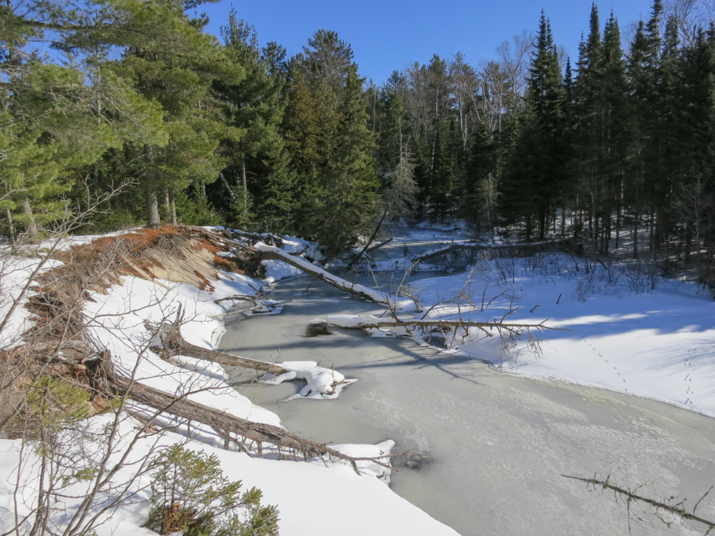
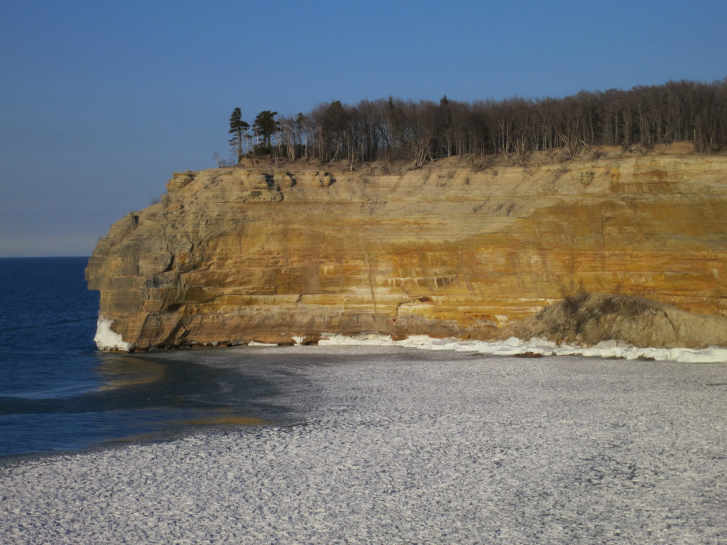
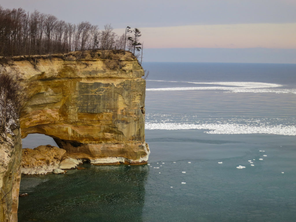
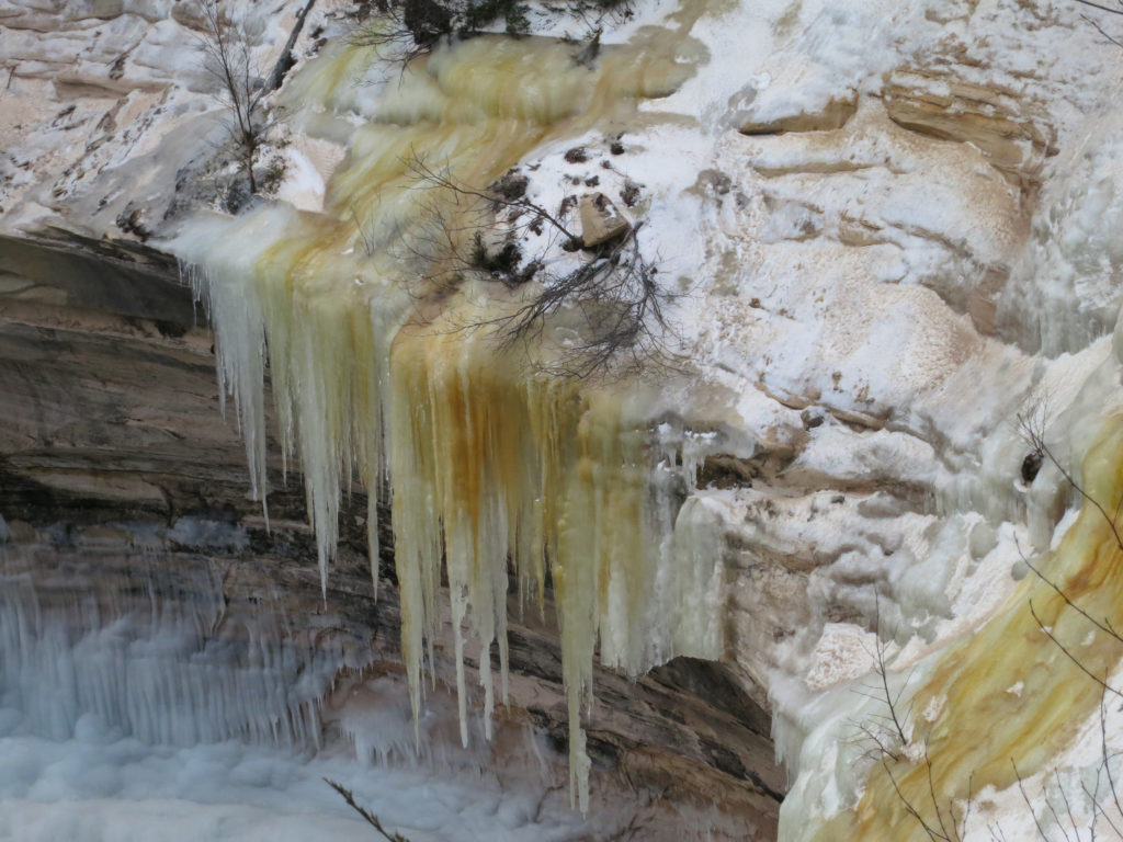
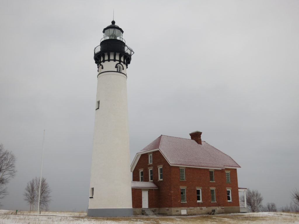
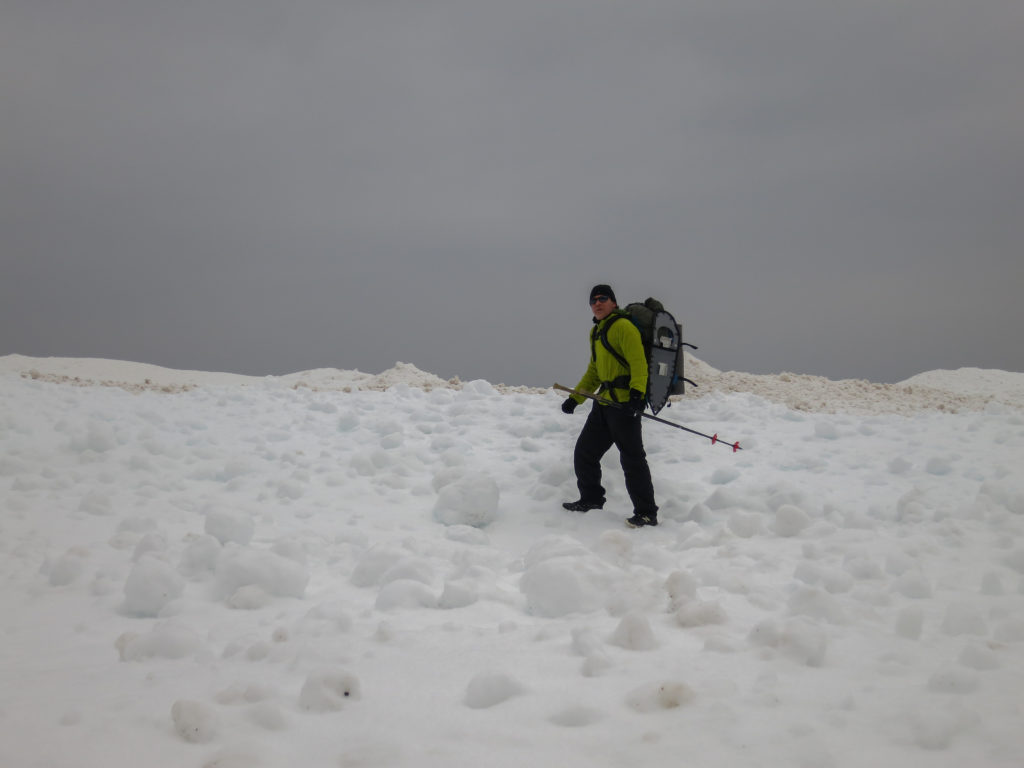
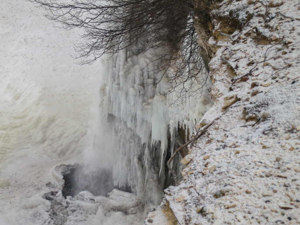
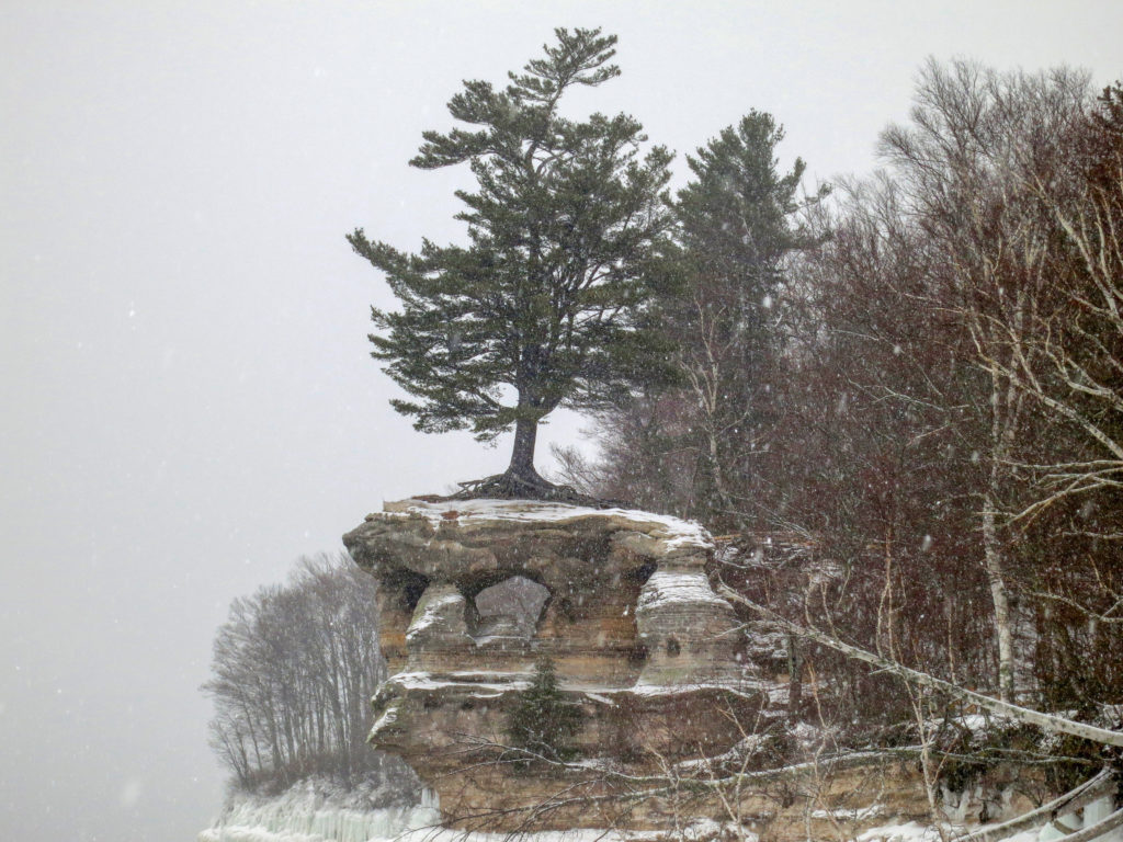
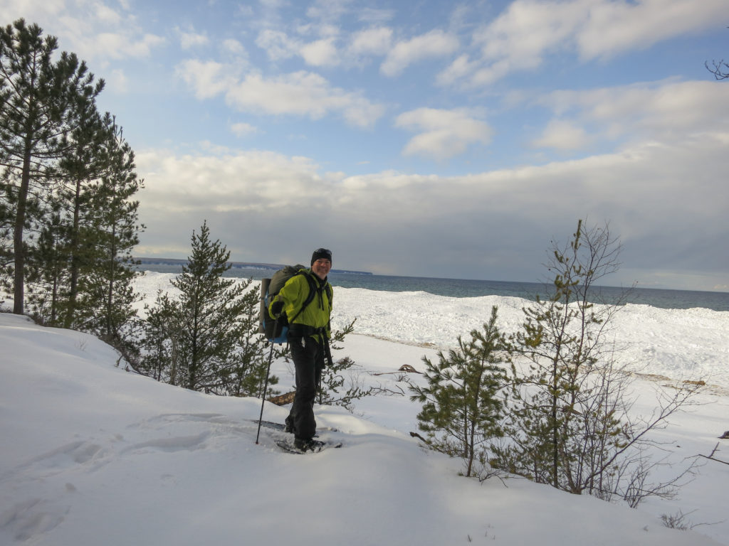
I began my hike at Munising Falls. The sun was shining brightly and the sky was a clear blue. The falls had frozen over, but water could be seen running right though the center of the frozen column. The first section was a snowy woods walk. Snowpack was significantly lower than I had expected, maybe a foot total, but I was glad for my snowshoes. Soon I reached Miner’s Castle.
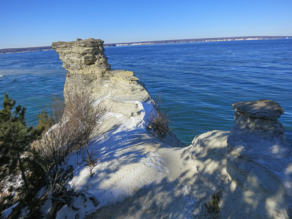
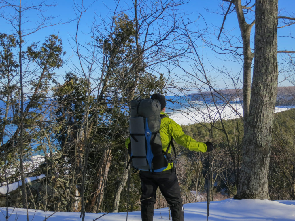
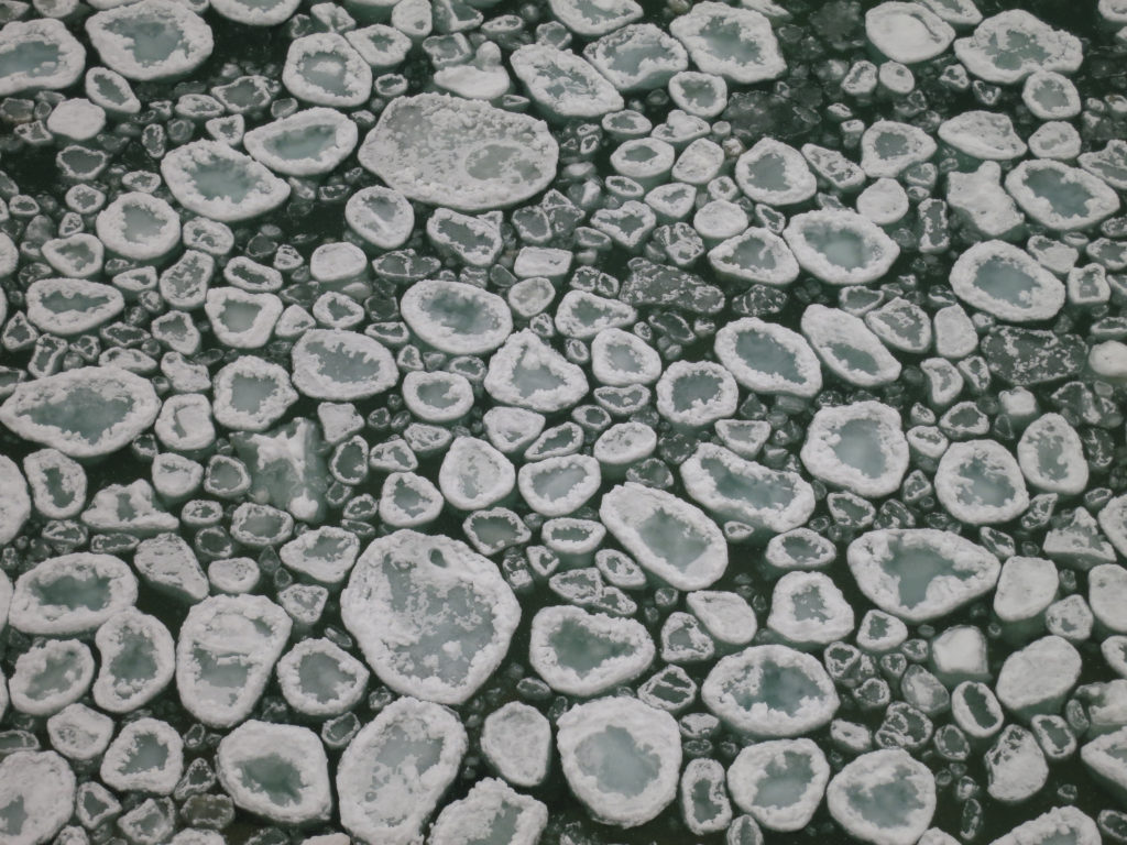
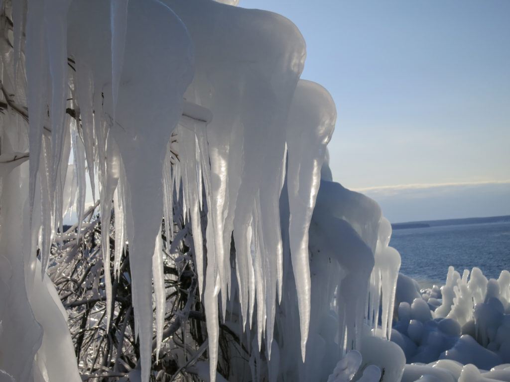
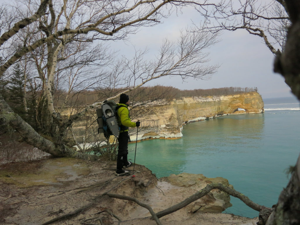
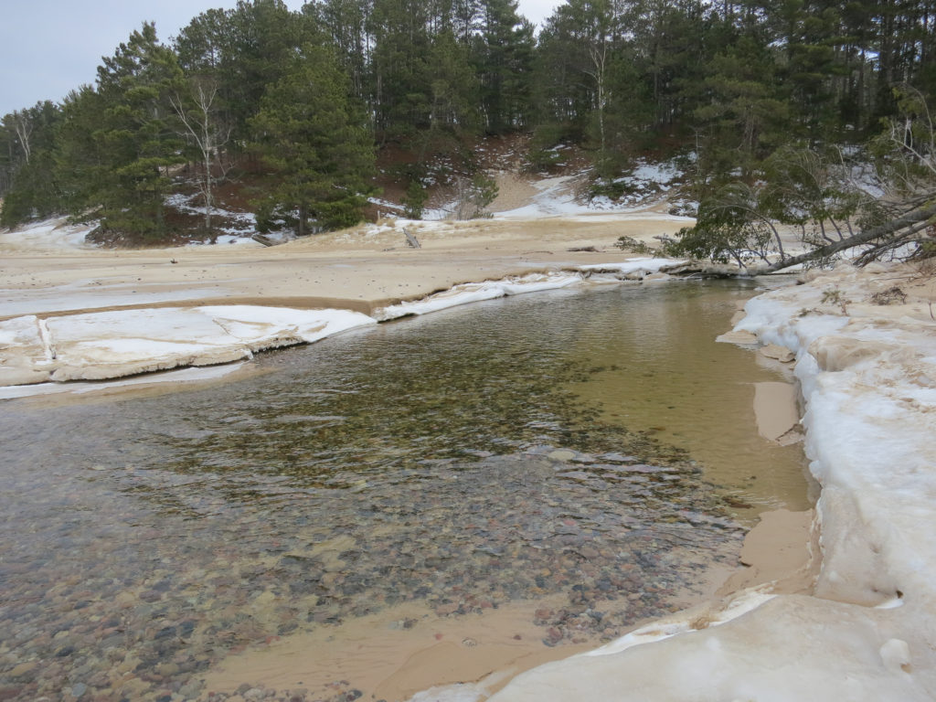
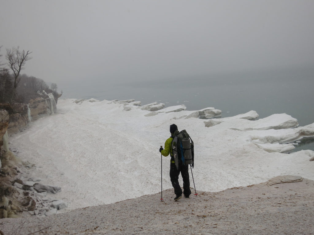
From the Castle, I could see a large ice shelf stretching across Miner’s Beach. I headed down the trail, soon crossing the frozen Miner’s River.
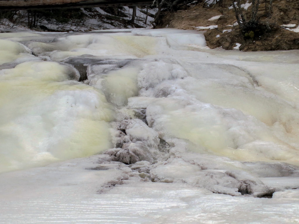
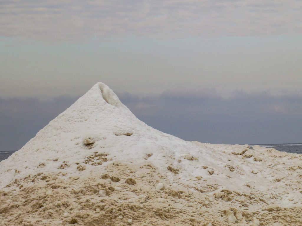
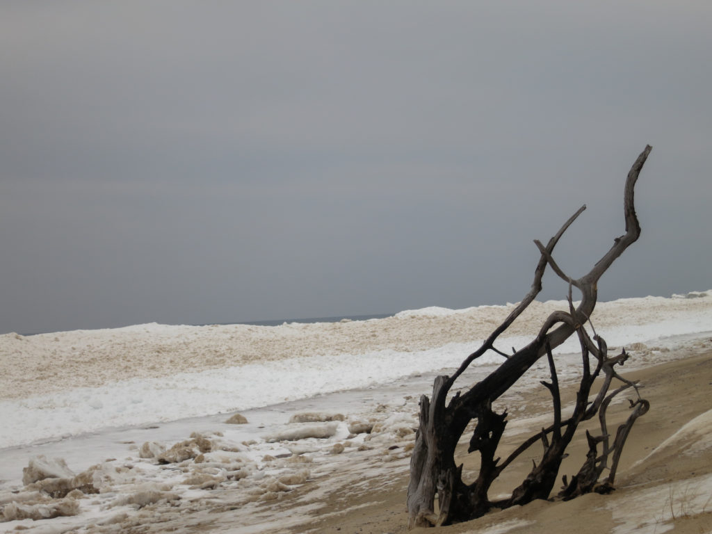
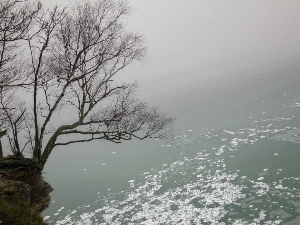
Once on the beach, I stopped for a while to watch Lake Superior batter the ice shelf into beautiful ice sculptures.
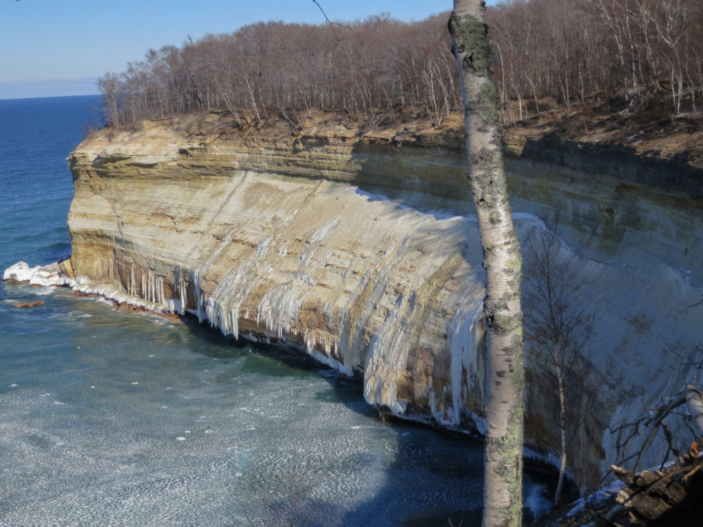

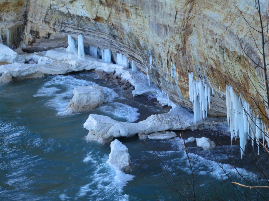
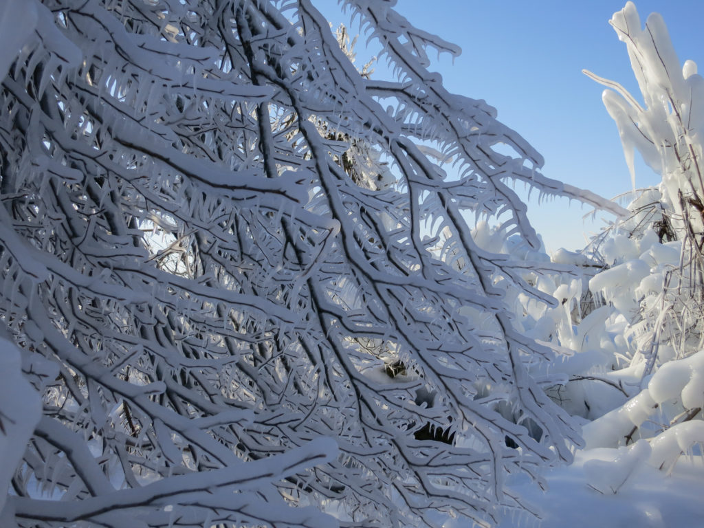
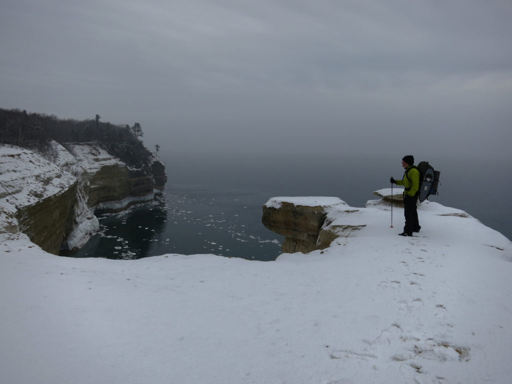
Passing Lover’s Leap, I suddenly found myself in a petrified ice forest. Spray from Lake Superior had coated the trees and frozen solid, making the trail completely impassible. Branches glittered frostily, and every few seconds I’d heard a crack followed by the booming thud of ice dislodging from the upper branches of trees and exploding on impact with the surface crust. I circumnavigated the area, looking up frequently to avoid the inevitable concussion.

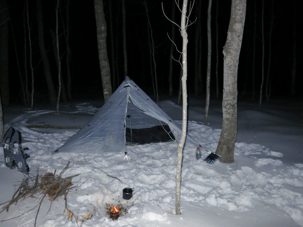
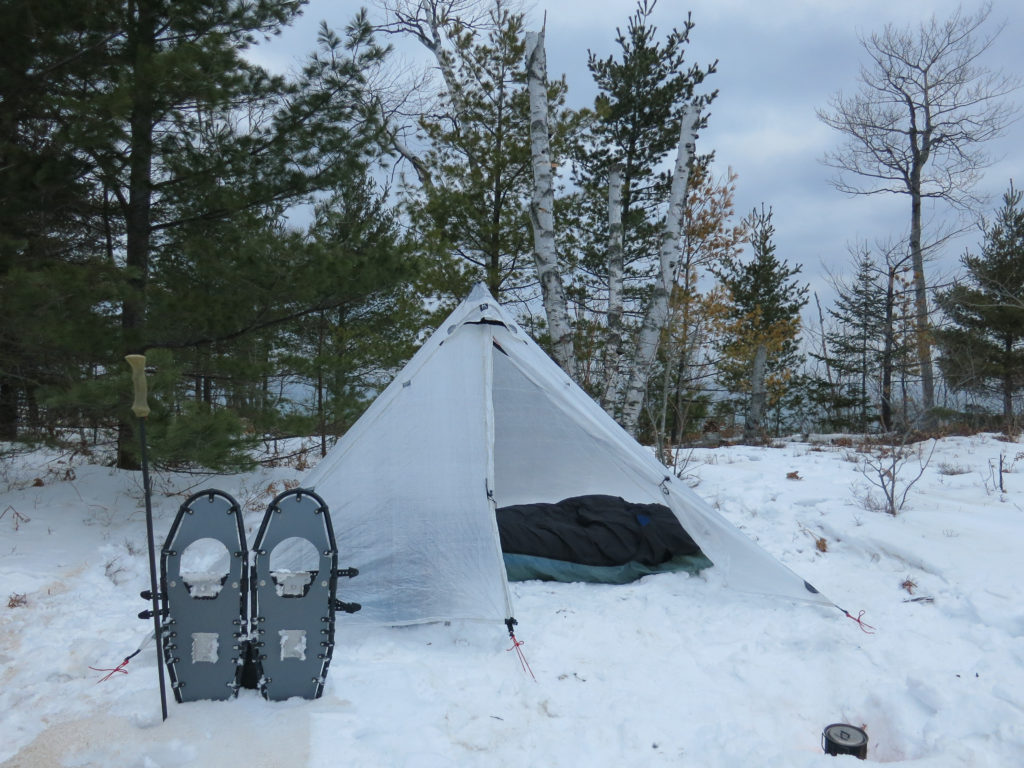
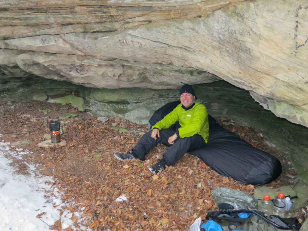
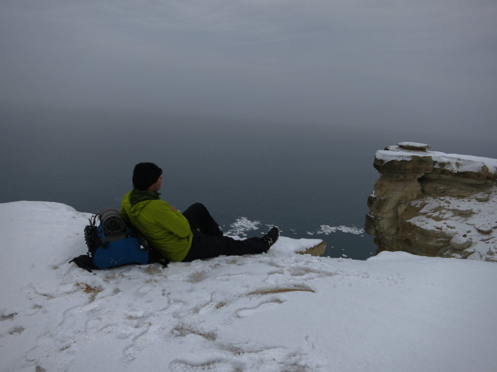
I continued to hike until passing Grand Portal Point. There I left the trail to find a small patch of clear snow to pitch my tarp.

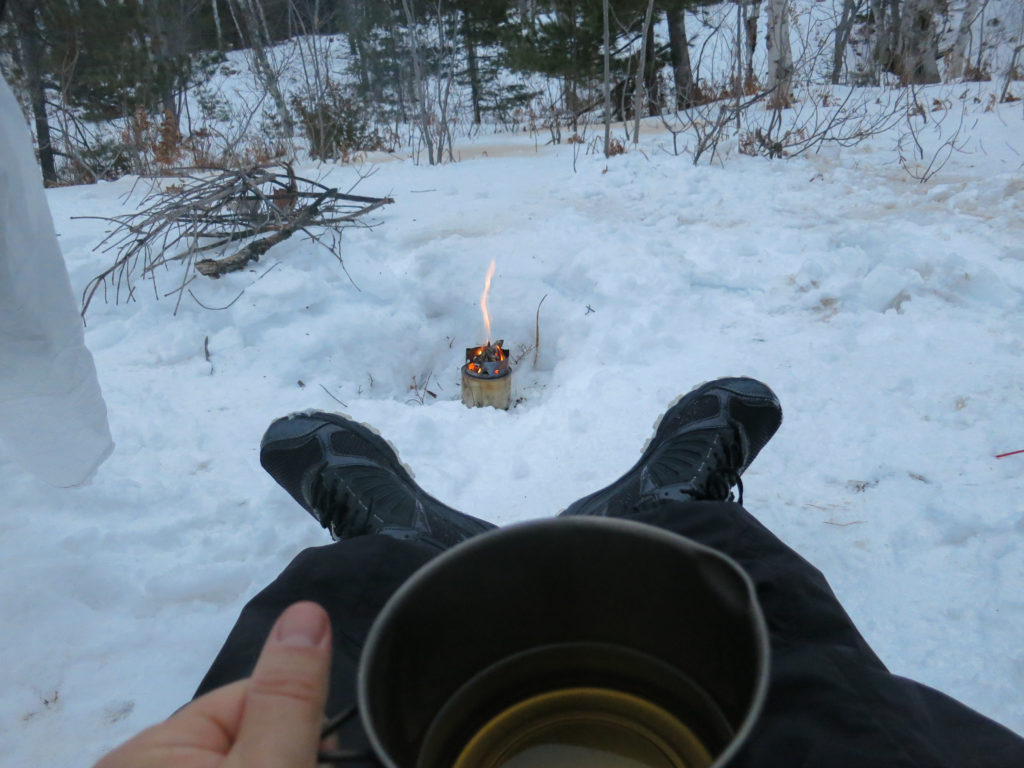
Tonight’s dinner was baked ziti with a turkey sausage based tomato sauce. As it rehydrated, I cut a giant chunk of butter and threw it in for good measure. Usually I bring along a bottle of olive oil for extra calories but in Michigan’s cold winter temperatures I’d been having problems with it solidifying in my squeeze bottles. This time I brought two sticks of butter, planning on a quarter of a stick in each meal. It was decadently good. Getting the frozen butter of my knife proved a challenge though. I tried scraping it in the snow but the butter was too tenacious. I ultimately settled on carefully licking it off. Mom would definitely not approve!
As I ate, I continued to feed small twigs into the bushbuddy for some ambience. After dinner, I heated a little extra water over the fire and added a good splash of whiskey to it. For this trip, I had brought a cheap Canadian whisky called “Rich and Rare”. Ironically it was neither, but I had come to like it in Alaska where I couldn’t afford any of the better stuff. Cheap whisky and sleep deprivation worked their magic and soon I was out cold.
I woke to the pale glow of dawn through tarp walls. I heated water using an esbit tab to speed my morning departure and sipped coffee while I broke camp. Breakfast rehydrated in my cozy as I walked. Next stop would be Chapel Beach.


I stopped to eat breakfast on Chapel Beach. It had taken me close to an hour to get here, so my potatoes had gotten a little cold. “Food is fuel”, I thought and ate it anyway.


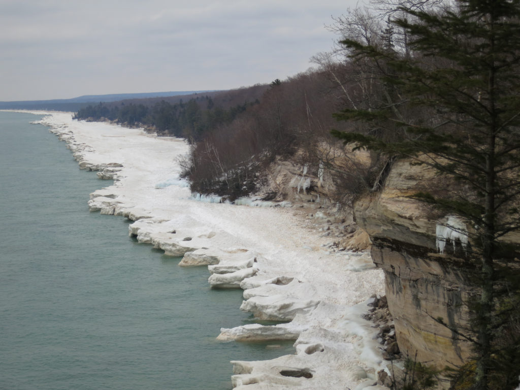
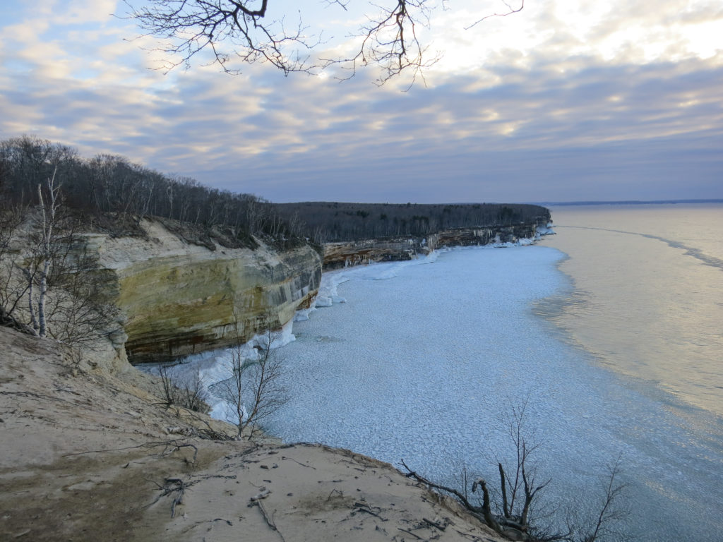
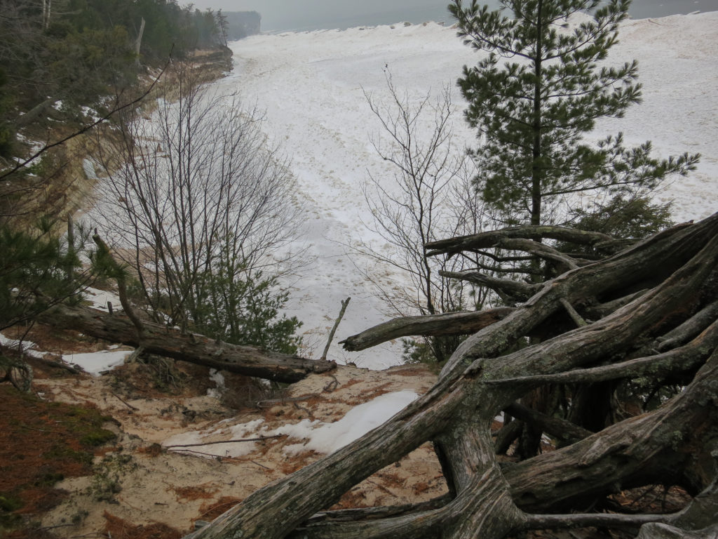
As the cliffs grew progressively shorter, I climbed down onto the ice shelf to continue my trek eastward.
First a quick warning. The ice shelf should be considered dangerous and unstable. Snow bridges may hide gaps in the ice. Stepping on one of these could plunge the unwary into Lake Superior. The water can also undercut seemingly solid chunks of ice and you would not want to be on one when it broke off and fell into the lake. The ice shelf is 20 feet high in spots, and attempts to climb out of the lake would be unlikely to succeed. Please do not take this trip report as an endorsement to hike the ice shelf when visiting Pictured Rocks in winter.

At least it sounded like God. Thunderous voice and the whole light beams from the clouds thing. On second thought, I’d been hiking for a while and was probably just delusional. I mean, why would God command me, “Thou shalt make it to the Dogpatch by 11 am on Friday before they stop serving breakfast.” Nonetheless, it sounded like good advice and I planned to follow it, you know, just in case.

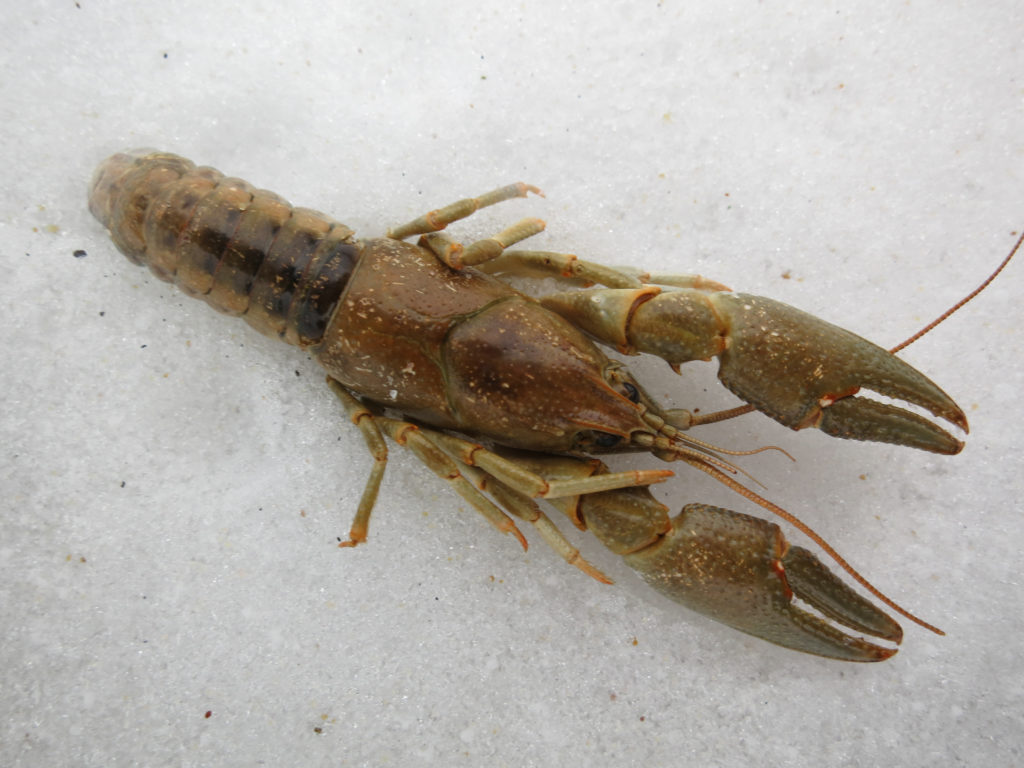
As I neared, a coyote sprinted from the ice and into the woods. A second, larger coyote followed soon after. I went over to where they had been, curious to see what had brought them out onto the shelf.
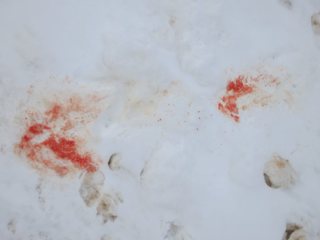

There I found the excavated carcass of a deer they had been feeding on. I looked warily at the gnawed femur bone, marveling at the power of the jaws that had done that.
I soon crossed the frozen 7 mile creek, assuming this meant there were 5 miles remaining before I finished traversing 12 mile beach. A mile or so later, I was ready to stop for the night. I had developed blisters at the base of my first and second toes on each foot where my minimalist shoes did little to protect my feet from the pressure of the snowshoe crampon, While I had successfully ignored this all day, each step was starting to feel a bit like crucifixion.
While my dinner (bowtie pasta with chicken) rehydrated, I sat in front of my fire sipping a hot whisky drink and watching the darkness fall. I complimented myself on figuring out that if I swirled my knife in my hot beverage, the butter licked right off. It’s the little things in life. I was in my bag by 7 pm.

I woke in the darkness, well rested, and heated some water for coffee. Still tucked warmly in my bag, I drank my coffee and ate a quick breakfast. I used the upper part of my stove as a coaster to keep my coffee from resting on the snow and getting cold too quickly.
I could see an outcropping of land in the distance and headed towards it, hoping it was Au Sable Point, the furthermost point on my trek. It wasn’t.


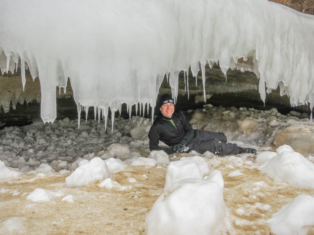
I made my way back down 12 mile beach in good time, arriving at the Coves section of the trail by 4:30 pm. Leaving the shelf, I climbed back up toward the trail where I found my evening accommodations awaiting.
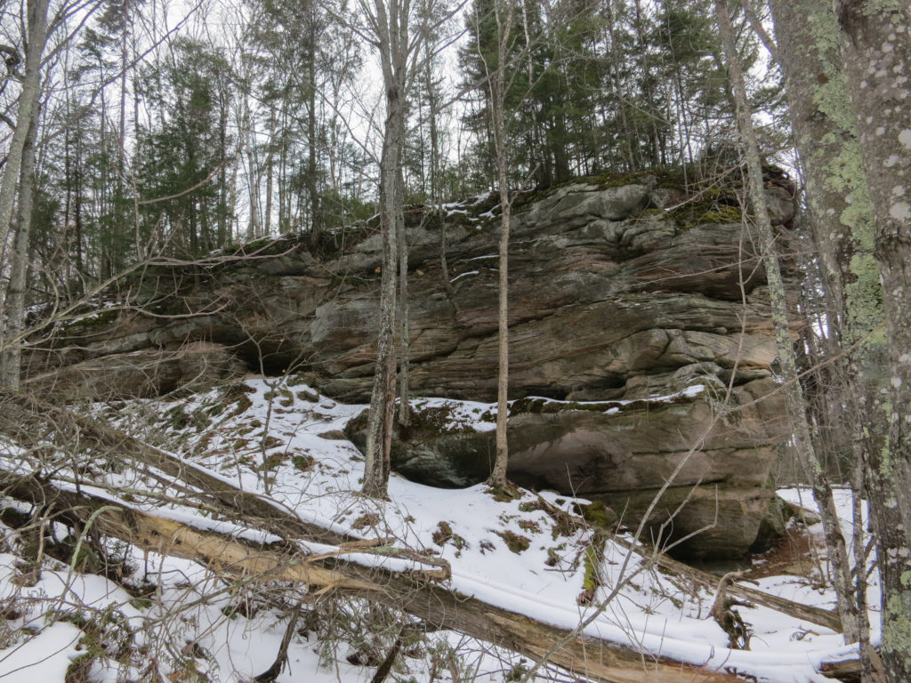
It had its own snow covered terrace, a flat sleeping area, and a narrow ramp that would be perfect for keeping the wolves at bay should they come in the night.
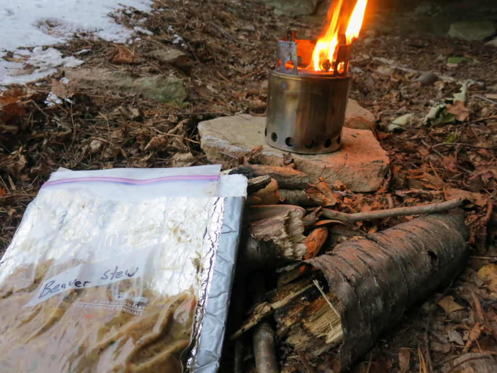
Dinner that night was a little unusual. The main ingredient had been provided by a wildlife veterinarian I worked with who knew me as an adventurous eater. As it turns out, beaver is not bad if you can get past the many short hairs that are inevitably associated with this elusive creature.
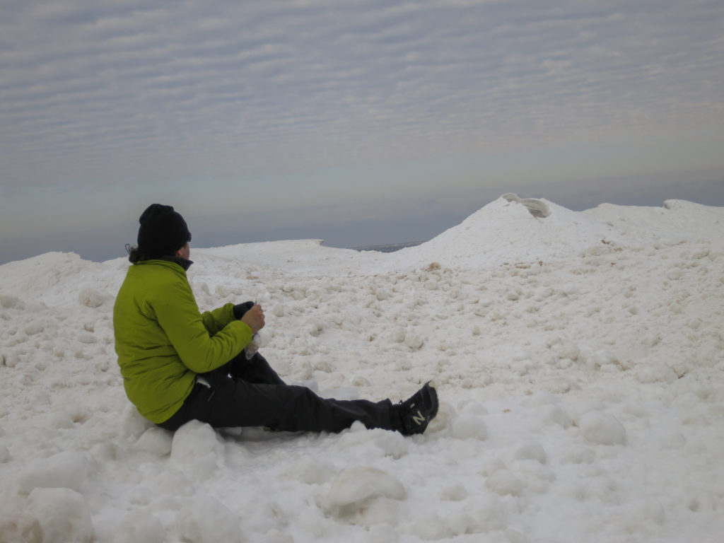
As I ate, I felt imbued with a sense of contentment. I knew that if I pushed hard I could make to to my car by the following evening, but I had no desire to do so. I had the green light to be out here till Friday, and wanted this trip to last as long as possible. I resolved to slow down the next day to make sure the trip lasted at least one more night.
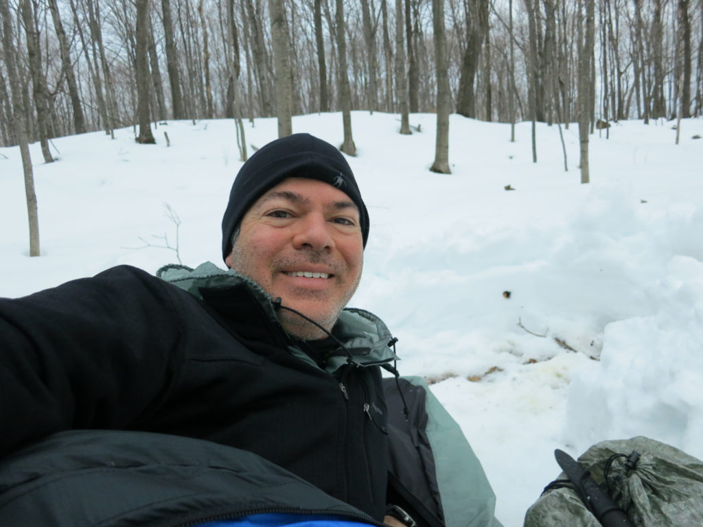
Climbing into the enclosed space of my bag that night, I noted that I was starting to develop what I called “VBL funk”, that odor of fermented sauerkraut and smelly feet that suggests you’ve been marinating in your own bodily vapors for one night too many. It was a little gross, but also kind of rewarding, a perverse badge of honor reminding me of what I had accomplished over the last few days.

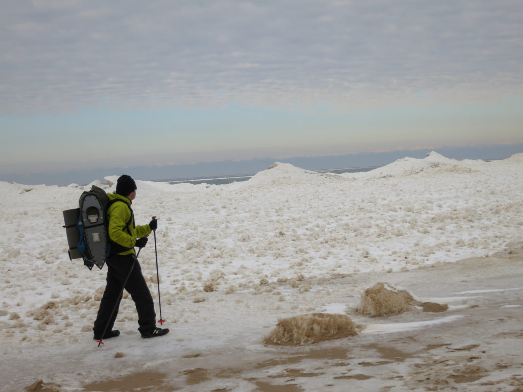
My initial concerns about covering the same ground I had already traveled turned out to be unfounded. Changing cloud and ice patterns and two days of falling snow had completely changed the terrain.
I hadn’t seen anyone in 4 days, but as I made my way through the heavy oatmeal and sand snow in this section, I ran into a real character. He had a red flannel shirt, tall white Mukluks, a heavy sled packed with gear, a twinkle in his eye, and a beard like Santa Clause (that is if Santa dyed his beard fluorescent yellow). He called himself “Dogger” and told me he was heading out on the AT in the spring. We talked about trail conditions for a while and then wished each other well.
As dusk fell, I decided to bivy in the woods overlooking the cliffs. This mostly stemmed from a desire to look up at the night stars, but also at the back of my mind was a hasty morning departure, if I wanted to make breakfast in town the following day. I dug down a foot or so and piled the snow around my site to act as a windbreak. I reserved my favorite supper for last, quinoa elbows with sausage in a spicy tomato sauce.
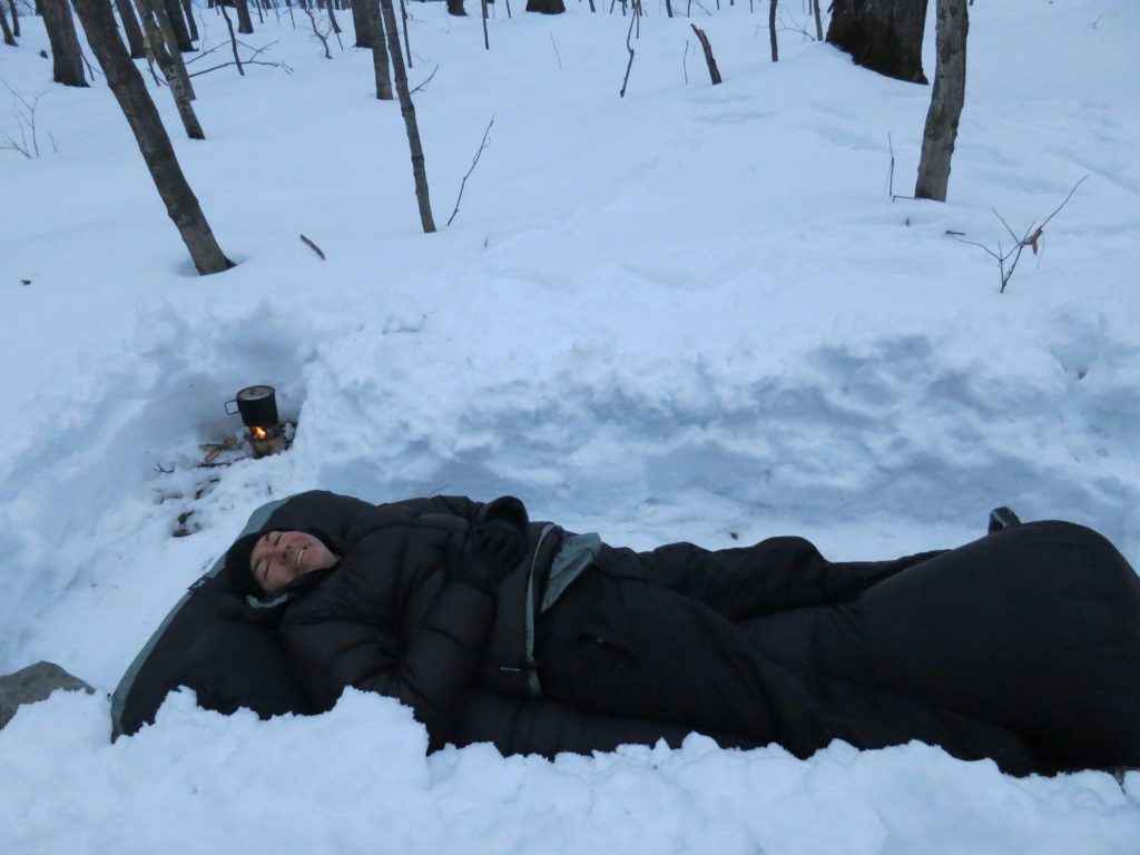
It took me a while to fall asleep that night. First I needed to make a mental readjustment to sleeping out in the open. It’s amazing how the lack of millimeter thick walls can lead to loss of security, as if that sheer fabric could protect from roving wildlife, the elements, or falling trees. I watched the branches sway overhead. I had selected this site based on the lack of large overhanging branches, but as the winds gusted, I wondered if I had accounted adequately for falling trees. The probability of being crushed seemed low, and yet…
Then I began to wonder whether the coyotes that had fled so readily by day would be more likely to predate a human found prone at night. I guessed it was probably more likely than during daytime, but couldn’t recall a coyote attack ever documented in Michigan. Maybe it was because normal people didn’t sleep out in the snow in areas so overrun with coyote. Catching a sudden whiff of myself, I decided that any animal that smelled me and still wanted to eat me afterward probably deserved to have me. Reassured, I finally drifted off to sleep. I woke in the night to the feel of cold snow falling on my face. Zipping up the net hood of my bivy handily took care of this problem.
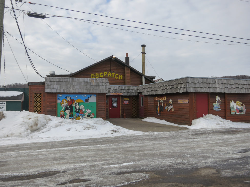
I arrived at the Dogpatch just before 11. “Sit anywhere you like”, a chatty waitress said. For obvious reasons, I picked a table way in the corner, very self-conscious about my odor. Leafing through the menu, I found a special called the Country Boy- a heaping plate of biscuits and gravy, served with a second plate of hashbrowns and sausage. It sounded almost perfect.
I had mine with 3 eggs on top.
Post trip thoughts: Speechless. This was an awesome trip. I found everything I was looking for. I hope I’ve inspired you to consider a trip to Pictured Rocks in winter. This is unquestionably one of the crown jewels of Michigan. And if you do it in winter, you just might see some things that few before have ever seen.
Ike